Thursday, December 02, 2010

Running fitness, as measured by heart rate


Having had a couple of months with no running (but lots of cycle commuting) due to injury, I've started to get back running.

On Monday I went for a 5.6 mile run with Andy Perry and it felt like hard work.  My average heart rate was 169 bpm.

I looked back through my previous runs which I store in SportTracks to see how that compares.

1) Similar heart rate

21 July, 5.1 miles @ 7:16 min/mile with heart rate 172 bpm
11 Aug 2010, 6.36 miles @ 7:31min/mile with heart rate 168 bpm

2) Similar pace

5 Aug 2010: 5.1 miles @ 7:54 min/mile with heart rate 160 bpm
17 Aug 2009, 6.26 miles @ 7:59 min/mile with heart rate 148 bpm

These results show they I'm less running-fit now than in the summer, and much less than I was last year.

Compared to 17 Aug 2009, I'm having to work at 21 bpm more to go a touch slower over a shorter distance.  Grrr!

It's not all bad though:

* I did a fairly good parkrun this year though - I came 20th out of 159, and I'm still top of the Hursley Park Runners team.

* Until August when I got injured I had been (very slightly) over-achieving my yearly goal of averaging over 2 miles/day

* Andy and I did the Farley Mount loop in August: 10.35 hilly miles at 8:24 min/mile pace and it was very comfortable

* I enjoyed putting together a view of all the routes I've covered running from Hursley (and we've since run a couple more roads too)

Thursday, September 02, 2010

Andy crashed his bike, again.

Nice 25 mile cycle ride this lunchtime, although it wasn't so good for Andy Perry who crashed on some loose gravel near Ampfield.

He also crashed immediately after restarting when he was in too big a gear, didn't engage his cleats quickly enough and fell off sideways.

He still managed the rest of the ride, averaging 16.1mph, but he has some sore body parts now.

Andy's injuries 3

Andy's injuries 2

Andy's injuries 1

Wednesday, September 01, 2010

Selling my iPhone

Having aquired an iPhone 4 (yes, it's awesome and no, it hasn't dropped any calls), I wanted to sell my iPhone 3G 16GB.   It was in pretty good condition, having been covered by an InvisibleShield most of the time.

Starting with the MoneySavingExpert article I looked at the various options listed at MobileValuer to see what I could get.

Based on the terms and conditions and the feedback I read Envirofone seemed the best bet.  I chose £158 cash instead of Argos vouchers.  Today, Envirofone is listed as offering the second highest amount of the 10 options. I don't think they were that high when I made my decision.

2010/08/05, ordered
2010/08/08, received an email saying that I had qualified for Collect+. This saved me the postage fee.
2010/08/09, sent using Collect+ at a local petrol station
2010/08/12, received email saying "We have now tested the mobile phone you sent to Envirofone and are delighted to let you know that it has passed successfully, meeting all our terms and conditions."
2010/07/17, full quoted payment received via BACS transfer

Friday, August 13, 2010

Andy's cycle commute


On Wednesday evening I cycled with Andy Perry to his place near Fleet.

We took the southerly route, which is longer and more hilly, and saved a little treat for the end when we tackled the steep hill to Ewshot and sped down the other side at 42mph.

After an evening watching the England-Hungary match with beers, chips, pizza and cornish ice-cream we had an early night and got up at 6:00, had a quick breakfast and set off at 6:29.

For the return leg we took a shorter (37.5 versus 42.5 miles) much flatter route - about half the amount of climbing.  We averaged 16.1mph over 2:18 moving time (2:30 elapsed).

We made it in to work at 8:59 but strangely Andy didn't fancy doing a 10k run at lunchtime.

Wednesday, July 14, 2010

iPhone 4 versus Samsung Galaxy S photos

Statistically irrelevant no doubt, but even so, here are some photos taken within 30 seconds of each other of approximately the same scenes.

Round 1 - inside, quite close up


Top is Samsung, bottom is iPhone 4.  I know which I think is better.  The original images are available to examine by clicking on the images below.


Round 2 - Outside


We examined these photos "blind" (ie, we didn't know which image was taken by which phone).  We mis-identfied which image was which. Overall, they're pretty similar but the windscreen of the silver car, 3rd back on the left, is better in the Samsung photo. 


Sunday, June 20, 2010

Cycling to Wales


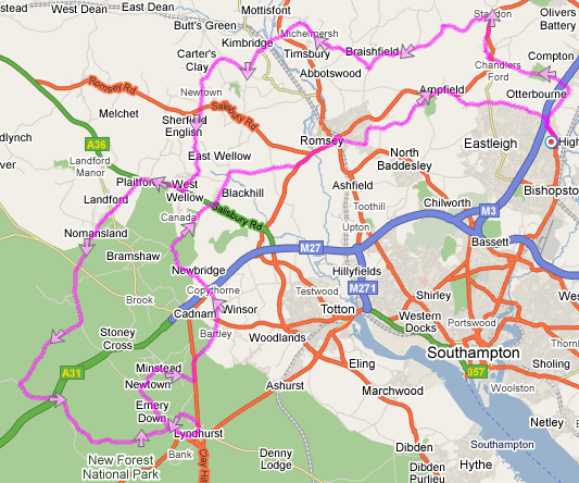
Last weekend we cycled to the Brecon Beacons and back. "We", is Mark Halliday, Ian Vanstone, Rich Harran and I. Over 3 days we cycled over 300 miles and climbed over 3250 metres.


Day One


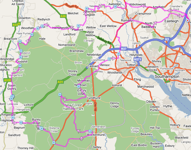
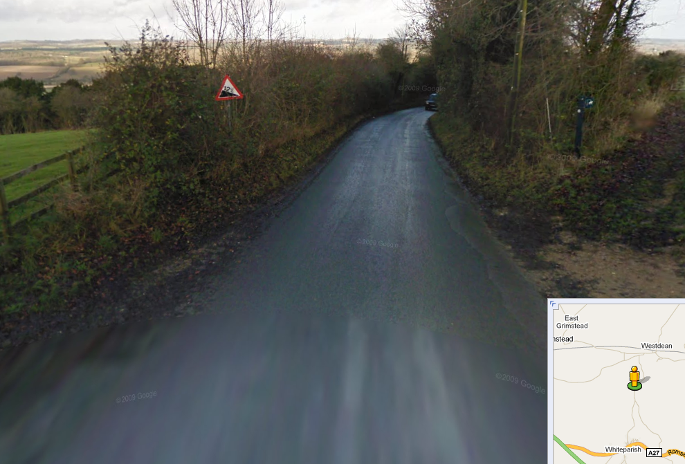
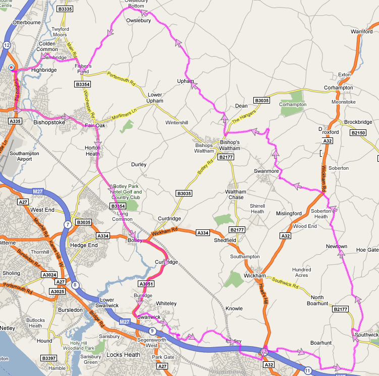
(route) We set off from work at 12:20 on Friday, the early light rain having thankfully cleared away. Mile one was downhill and flat but then we had our first mini-climb of 80 metres up to Farley Mount. This is one of the hardest hills near work but it would pale in to insignificance by the end of Saturday.

We followed the Garmin Edge 705 Sat Navs directions to Stockbridge, taking a route I hadn't done before. We set our top speed of the day of 39mph down the B3049 in to town.

Between us we had 3 Garmin Edge's. I think this is because they're so hard to follow that you need significant redundancy. And like the Space Shuttle's control system, when one system disagrees with the other two, you can follow the directions of the two that agree.

By 1:40 we were skirting Andover heading generally north. This began the longest, ever-steepening climb of the day, from 119m to 277m in 5.1 miles. Not very tough but 25 minutes of uphill. Followed by a lovely 102m descent in just 1.1 miles. And straight in to another 76m climb. And a 95m descent. Quite good fun really.

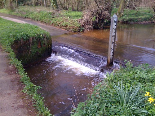
Then we zig-zagged around loosely following a river west for about 21 miles. Rich picked up a puncture which took about 20 minutes to repair - our only mechanical issue for the day. Between Alton Barnes and Stanton St Bernard we saw a chalk horse on a hill. The landscape around this area is striking. Rich commented that it was lunar: wide plains and distant bumpy hills. Really pretty.

At Bishops Cannings we turned north and climbed a short(ish) steep(ish) hill (58m in 1.3 miles) and gently swung west to cross the M4 north of Chippenham.

We cycled through a beautiful village made of stone called Grittleton. Check it out on StreetView, although I remember the place being far prettier than the linked imagery suggests.

We reached Luckington, our destination, at 6:30. We were very generously being put up for the night by Kirsty, a friend of Mark and Ian.  After a quick shower we went to the local pub, the Old Royal Ship.  The World Cup started today and France were playing Uruguay.  There was a big screen in the pub but we sat outside in the evening sunshine. Turns out we missed a poor 0-0 draw anyway.  After a lovely meal and a few beers with Kirsty and John (her man) we headed back for a relatively early night.
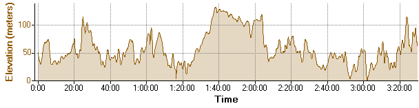
Day Two


(route) This is the one I'd been fearing. But it started well with a top quality cooked breakfast (thanks Kirsty).  We were rolling before 8:30.

The first task was to get to the M48 bridge to Wales (the M4 bridge doesn't cater for bicycles). The first hour of the day was mostly flat and we averaged 16.5mph. For one 2 mile section we averaged 22mph (although we did drop 53 metres).

Ian had been looking forward to crossing the bridge and I can see why. You're quite high up and the views are fantastic. Looking down in to the water you can see swirling currents moving in all directions.

Once in Wales the sun came out and we headed north past Chepstow and turned west and up a hill on the main road. First gear was employed but it was fine. My bike has a "double" not a "compact" crankset. This means that my easiest gear is significantly harder to turn than a compact - which the other 3 cyclists had. My easiest gear is 39x27.

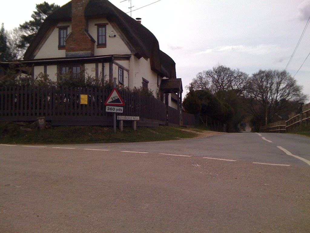
At the top of the hill we came off the main road and descended a tiny single track road. Then we were introduced to our first real hill. For the next 0.65 miles, the road *averaged* 11%. Blissford Hill in the New Forest is 25% but that was nothing to this. We ascended 112 metres in 1040 metres. Sitting down for this climb was not an option. It felt like I had to stamp on one pedal while lifting up on the other just to turn the wheels. Our speed dropped to about 3mph. There was a lot of heavy breathing. At one point everyone but Rich dismounted because it was crazy steep (28% according to GPS) and the road was covered in small pine cones that made it slippery. At the top we caught our breath, admired the view back down over the estuary and scoffed chocolate. This was the first time I've had to dismount due to gradient. But it wouldn't be the last...

Coming down the hill on the other side was quite hard work as the road was small and twisty so we had to use the brakes all the way down. 234m elevation down to 46m and apart from lovely views, no benefit. Grr.

Ian started to make noises about his gears not feeling right but we headed down in to Usk for a bite to eat before he took a proper look. I emerged from the One Stop with a tonne of sarnies and wraps to hear Ian say that his chain was bust. It hadn't snapped (wait for tomorrow) but one of the links had split and looked very weak. Mark had brought spare chain pins so Ian took out a couple of links from his chain and got it all fixed. A quick lunch ended up taking 50 minutes but at least it was sunny and the rest of us enjoyed a leisurely lunch.

Shortly after 12:00 (38 miles) we saddled up again and followed the river to Abergavenny. En route Rich picked up another puncture which was fixed without any drama. We went through the middle of the town. It looks like a nice place, nestling among some big hills. Worth visiting some time.

We took the flat Brecon Road out of town for 7 miles, which concluded an easy 20 mile flat section. We turned right on the A479 which had recently been resurfaced and was lovely and smooth. With the strong sun and recent tarmac I feared it might be soft and sticky but it was perfect. We climbed up the A479 for the next 7.4 miles, gaining 240 metres. Long, but not too bad.

From the top we loved the descent to Talgarth on the new road surface. 189 vertical metres dropped over 3.2 miles in 8 minutes at an average of 24mph. Sweet!

Along a country lane Rich and I saw a large predatory bird take off and fly just over our heads with a decent sized black bird gripped in its claws. Nature in action!

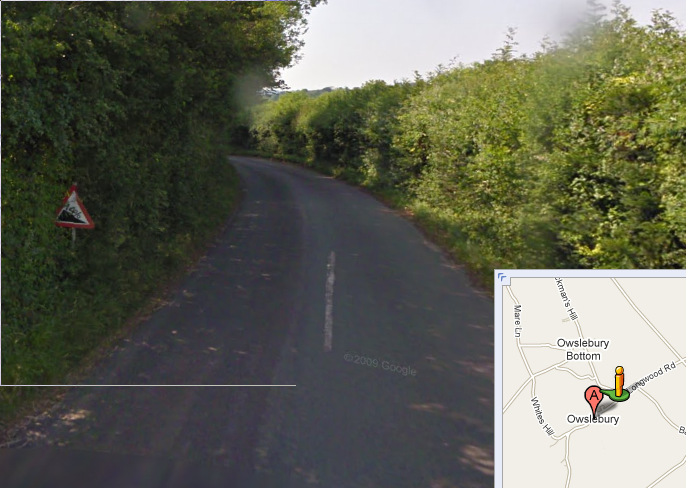
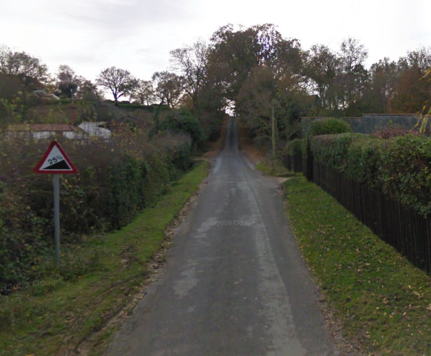
The big climb of the day was just around the corner. We approached it by coming up a steep hill, then the road kinked steeply upwards, looking quite a lot like a vertical wall of concrete. You can't see the gradient very well on StreetView, but if you look at the fence posts on this image you can kind of see it. The GPS trace suggests the peak gradient was around 35%. I had to dismount, again. For the first uber-steep hill of the day I had walked up it in my cleated cycling shoes which isn't very easy because the cleats exacerbate the angle at your ankle, but this one was so long I took off my shoes and walked sock-footed until the gradient eased off to something more sensible like 15%.

For 5.6 miles we rode up a narrow road taking in some amazing scenery.  We climbed from 385 metres up to a peak of 530 metres.  Whilst tough, this part of the ride was what we came for and it didn't disappoint.

For the next 12 miles and 40 minutes (!) we dropped down the valley from 530m to 113m. And then ground up another 110 metre climb, what looked, from the graph, like the last real ascent of the day...

But wasn't. Just after we crossed the A40 the road went straight up a ridge, gaining 80 metres and peaking at  21% gradient. This one was tough but was conquered.

All we had left was the road to our destination which the others had done before and said it was a bit steep. We'd had a nice 106 mile warm up and only faced another 75 metre, 0.5 mile climb. With a gradient tightening to 20% for the last 200 metres. I gave it a big push, resolved to make it, but had to dismount just 40 yards from the end as I wasn't getting enough oxygen and my lungs were about to fall out.

We finally reached Ian's Aunt and Uncle's place at about 6 o'clock, having cycled 107 miles in 9:33 and climbed 1475 metres.

After a quick bath we sat outside on a picnic table for tea (thanks Joy) with awesome views over the valley. What an amazing place to live. We heard lots of interesting stories about the trouble the heavy snow caused earlier in the year. Pudding was excellent too - home grown rhubarb made in to a delicious fool. Truly scrumptious.

Then we watched the England game with a couple of beers and some smoky bacon crisps (of which they had a surfeit) before giving up and (again) having a relatively early night.
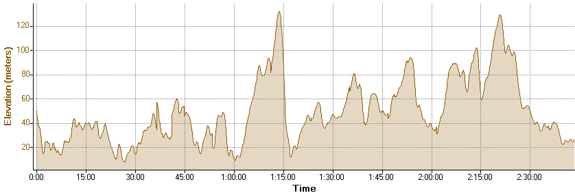
Day Three


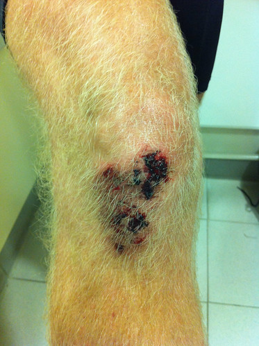
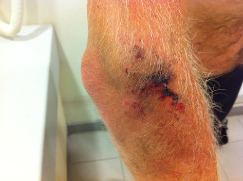
(route) Everyone slept like kings although I did head to the loo in the middle of the night and forgot that there was a couple of steps out of the bedroom to the landing and took a tumble. I received a whack on the knee which could have been disastrous but wasn't. It felt a little bruised and tender the next morning but it didn't affect my cycling.

We were up for breakfast for about 8 o'clock. After lots of cereal and toast we were ready and set off at 8:50. It was a bit awkward getting started as our route continued up the steep hill we finished on last night but we managed it without incident.

We took a fairly main route back to the M48 bridge. The best bit was heading out of Devauden down a billiard table smooth road averaging 28mph on a 3 mile section that dropped 160 metres. Top speed was a touch over 40mph.

Over the bridge, over the M4, heading for Bath. I was hoping to avoid the worst of the hills:- I recently went to Bath and parked in the Park 'n' Ride at Lansdown near the race course and the hills round there were big! It turns out Mark had routed us that way as there isn't much choice if you're avoiding main roads. We climbed from 103m to 285m on a hot day having cycled nearly 200 miles over the previous 2 days. It was quite tough but we just took it slowly and ground it out. Some nice views though.

We turned left off the main road before the PnR and took some narrow lanes to the east edge of Bath, heading through Bathford and near Bathampton (imaginative names they have in these parts).

Mark had been warning us about a steep climb for a while and it arrived on Warleigh Lane outside Claverton.  It's about a 75 metre ascent over 1/3 of a mile. Mark walked part of it because he still has achilles and knee issues from his London-Edinburgh-London ride last year, and Ian walked part of it as he dare not stand on the pedals given the state of his chain. Rich and I both made it to the top without stopping which was satisfying given the 3 hills I'd walked yesterday.

Then we rolled down the hill in to Bradford-on-Avon. I hadn't heard of the place but it looks really cute. We were looking for lunch and we got directions to the local Sainsburys. We passed a bicycle shop and then literally 50 metres later Rich's chain appeared to explode. We later found out that the front dérailleur had slipped down the seat post and got caught in the chain, ripping it off. Rich found one half his chain but not the other half which had disappeared. I'm amazed at the luck of having a bike shop 50 metres away and that we wanted to stop for lunch anyway. Rich bought a new chain whilst the rest of us went to get food from Sainsburys.

We had lunch by the canal as Rich fixed his bike. Mark and Ian managed to mistake 2-litre bottles of water for 1-litre bottles so we had twice as much as we needed. A couple of bottles were gifted to a random passer-by.

We still weren't half way home so we got going once Rich had fixed his bike and had some food. We'd conquered all the nasty hills but we still had 60 miles to go. We went through Warminster and then followed the river for 22 miles to Salisbury. Somewhere in this segment we spotted another white horse. I haven't managed to find it on StreetView yet though.

As we got in to Salisbury there was a point where the road narrowed to a single lane. A BMW driver (what else?) saw 4 cyclists about to enter the single lane section and gunned it. We had to stop in a hurry and he flew past. He either didn't see or didn't care about the stop sign after the narrow bit as it emerged on to the main road, but on another day this could have ended in a nasty car crash. Idiot.

It's odd to think of Salisbury as "nearly home" but it felt like it. Less than 25 miles and I'd be home (although Ian and Rich had slightly further, and Mark 5 miles less than me). There's a bit of a hill out of Salisbury in to Aldebury, parallel to the A36, but tiddlers like this no longer bothered me.

Then it was over the A36 to the lovely flat terrain of the Deans, Lockerly, Kimbridge and home.

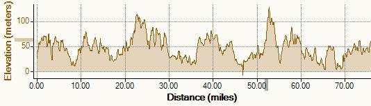
112 miles for the final day, 9:38 hours, 1050 metres of climbing.  (The elevation graph above is from Mark's GPS and doesn't show the full distance).


Summary Statistics

81.6 miles, 107.3 miles, 111.7 miles = 300.6 miles (plus a 5 mile commute to work for me).
750m, 1475m, 1050m = 3250 metres of climbing.  Highest point at 530m in the Brecon Beacons.
6:10, 9:34, 9:38 = 25:22 (including stops)
2 punctures, 1 new chain, 1 chain repaired.

Everyone was pretty tired by the end. I was developing saddle sores on the third day but otherwise was in remarkably good shape. I chose not to cycle to work on Monday and on Tuesday I do the school run. I cycled Wed, Thurs and Friday though. Rich cycled every day the following week.

Over the 3 days, as well as big meals, I had:
  • 5 KitKat Chunky
  • 4 Snickers
  • 2 bags of Haribo Super Mix
  • 2 bottle of Lucozade
  • 2 Alpen-like bars

Mark had planned the route using BikeRouteToaster.com which is a great tool. It can reroute by dragging like google maps does, it shows elevation, it has lots of import/export options, and it can show maps from and route over OpenStreetMap. Superb.

Rich and I took rucksacks but Mark and Ian packed everything in to their jersey pockets and various saddle bags. I used sun cream but still ended up with sharply defined lines on my upper arms between pinky-brown and white.

Rich's pattern of one mechanical failure per day also continued on into Monday when his gear cable snapped on the way in to work.

Overall: a lot of fun, met some people, ate tonnes, saw many pretty views and villages, was defeated by and conquered some big hills, did back-to-back long days. Thoroughly enjoyed.

Thursday, June 10, 2010

Cycling weekend, before we go


Heading off tomorrow, Mark Halliday, Rich Harran, Ian Vanstone and I are cycling to Wales to tackle some hills, returning on Sunday.  The elevation profile above is for the second day.

This will be my first set of back-to-back long rides whereas the others have done Lands End to John O'Groats before.

Day 1 leaves work at midday and heads off to somewhere north of Bath.  It has the most short sharp ups and downs and covers 82 miles.  Forecast seems to be rain in morning and clearing later.  We should arrive at 7:00 where we can clean up and have a pub lunch.

Day 2 is hilliest and 105 miles long. Basically getting to the bottom of the valleys in 35 miles, then heading gradually up them, climbing up and out of the end, along, then back up into the top of the next one (miles 72 to 77 climb 400m)  before heading south and down it (miles 78 to 90 look sweet!).   Heading off at 8ish, or earlier if possible, we should  arrive at Ian's aunts by 5 to socialise before watching England v USA at 19:30.

Day 3 is longest and goes near Bath, which is pretty hilly.  It has a great run back along the river valley, the last 40 miles being on the whole downhill.  We plan to leave at 9:00, getting back for 6:30 or so.

I'm a bit nervous but massively looking forward to it.

Wednesday, June 09, 2010

iPhone usage analysis

I'm going to be replacing my iPhone 3G with an iPhone 4 shortly.  I got my current phone on an 18 month £30 contract - the cheapest available at launch.  I calculated that a PAYG option would have been cheaper for me but O2 didn't launch it until a few months had elapsed.

Given my usage pattern over the last 2 years, would I still better off with PAYG?

If O2 make it easy to see historic usage graphs then I couldn't find it.  After some laborious copying in to a spreadsheet I ended up with:

Talk minutes: average 23, min 9, max 51
Texts: average 40, min 22, max 78
Data in MB: average 165, min 107, max 292

This usage pattern was achieved whilst on a contract: for the first 18 months it included 75 minutes and 125 texts, and currently includes 600 minutes and 1200 texts (£20/month).  I used the phone fairly frivolously because I was always well within my allowance.


What about data?  O2 used to be "unlimited" but now has a 500MB limit, after which they reduce the speed.  This is according to the O2 rep responding to comments in the O2 blog where they announced the 500MB cap.

"If you go over your data limit and don't buy a Bolt On then your data speed will gradually slow down. You won't be charged further.


So it looks like a 500MB "limit" is fine for me.  I've only exceeded 200MB twice in two years.

iPhone revisions seem to be an annual occurrence so an 18 month contract seems odd.  Choosing 12 or 24 months is probably wiser, depending on whether you really need to have the latest handset or if you can survive the second year with a superceded model.

I currently get my broadband with O2 and I get a £5/month discount for also having a mobile with them.  The rest of the family are on Vodafone so if I switched mobile providers I'd lose the discount.  I've been content with O2's coverage although I think Vodafone would be better.  So unless Vodafone have a significantly cheaper option for the iPhone I'll be sticking with O2.

I've used over 90% of the storage on my 16GB 3G.  The current selling prices for the 16GB and 32GB 3GS are £237 and £282 respectively.  So whilst there is a £100 premium for the bigger version you should recover about £45 of that if you sell it after 2 years.  Given photos at 2.5 times the resolution of my 3G, and HD video recording, it seems prudent to make sure I've got sufficient storage so I'm only looking at the 32GB version. 

The low use and cost options that look like candidates are:

1) £30/month for 18 months.  £323 for 16GB version.   100 mins, unlimited texts

Over 2 years: £323 + £30*18 + £10*6 = £923

2) £25/month for 24 months. £249 for 16GB  version. 100 mins, unlimited texts

Over 2 years: £323 + £25*24  = £923

3) PAYG.  £599 from Apple (O2 aren't doing PAYG until they stop being able to fill their orders with contract customers).


O2 PAYG: When you top up with £10, you get 500MB and 300 texts to use within the next month.  So if you spend less than £10 on calls each month they you will be carrying over some credit each month.  Calls cost 25p a min for the first 3 minutes a day then 5p a minute for the rest of the day.

I used an average of 23 minutes when I was on contract - I'll use a bit less than that on PAYG, say 20 minutes.

20 mins * 25p/min = £5.00 on calling costs.

So each month I top up I'll end up with an extra £5 of credit.  At some point I will stop topping up and will instead spend PAYG credit on the Web Bolt On which costs £7.50 for a month of data plus texts at 10p and minutes at 25p/min.  Once my balance drops too close to zero I'll revert to £10 top ups again.

So the pattern may look something like this:


Month 1: £10 topup, data and 300 texts included, £5 spent on calls, balance £5
Month 2: £10 topup, data and 300 texts included, £5 spent on calls, balance £10
Month 3: £10 topup, data and 300 texts included, £5 spent on calls, balance £15
Month 4: £10 topup, data and 300 texts included, £5 spent on calls, balance £20
Month 5: no topup, spend £7.50 on Web Bolt On, £3 on 30 texts, £5 on calls, balance £2.


So 5 months costs £38.  24 months is about £190.

Total cost for 2 years of iPhone 4 32GB = £599 + £190 = £789.  Or £1.08 per day.

And if you can sell your iPhone after 2 years for £200, it's only £589 for 2 years = 80p per day.  Which is cheaper than a small coffee or bottle of coke.

Just for interest, if you used your iPhone like an iPad and could live with no phone calls nor texts (you will actually have 300 texts/month for 3 in 7 months):


Month 1: fund £10, balance £10
Month 2: buy Web Bolt On for £7.50, balance £2.50

you end up spending about £110 for 24 months (ending up with some credit).

My iPhone 4 is now ordered.  O2 have sent me a micro SIM and scheduled a switch over date to PAYG.  Can't wait.

Sunday, April 11, 2010

Tour de New Forest, #1

To mark the end of my Easter holidays I did a nice long bike ride in the sunshine around the New Forest.  I planned the route (GPX link) so that I took in a mixture of roads I'd never done before and some that I know are classics.

Lots of ponies

Went to: Hamptworth, Lover, Godshill, Frogham, Ringwood, Burley, Brockenhurst, Minstead, Calmore
Distance: 77.26 miles
Time on bike: 4:45
Average speed: 16.2mph (including stops = 13.9mph)

Route of the New Forest ride

I set off at 9:44 and whilst there was a small nip in the air it was definitely shorts and T-shirt weather.  The first 8 miles were the most direct route going north of Romsey to get to the good stuff.   There's a really lovely lane named Coombe Lane leading west from Awbridge.  It's narrow, has a fairly good road surface and has some beautiful houses and estates and a pretty pond.  Definitely worth doing again.

Ford

Most of the roads on the route I took from Awbridge to Plaitford were really pretty - highly recommended, although it does seem that whichever way you go you'll have to ford a stream (or take the footpath bridge over it).

The route then followed the A36 for 0.8m but the white lines that define the sides of the road effectively provide a cycle lane and it's gently downhill all the way so it's actually quite nice.


A nice place to live

Then I went along roads that are just outside the boundary of the New Forest but they are still picturesque.  The village of Lover came next, which always makes me smile.  The uphill route out of Lover finally got me up to 110m elevation which is not far off the highest in the New Forest.

You see several of these in the New Forest

Then it was through Hale and Hale Purlieu to Woodgreen where there were lots of roaming ponies and a horse drawn carriage.  Then up and down some hills in to Godshill and down the main road, turning off for Blissford.

25%, here we come.

By this point I was kind of nervous as I was about to tackle a hill with a 25% warning sign.  I stopped before the bottom and thoroughly enjoyed a gooey Caramel egg (many thanks to my in-laws for that; it really hit the spot).

In the end it was a bit of an anti-climax.  It was definitely very steep but my bike didn't creak worryingly as Mark Halliday had warned me and it was all over very quickly.  Compact cranks?  Pah.  But I did notice that I was panting quite hard for the next minute or so.

Then it was down through Frogham and along the flat roads through North and South Gorley. I caught up with a car that was patiently following a tractor.  I drafted the car for a few seconds but then stood on the pedals and accelerated past the pair of them - whoooosh!  Fun.

Old car meeting

At the ford south of the Gorleys I saw a procession of old cars go by, then I saw them parked up for a meet 1/2 a mile further on.  I also noticed a sign that you don't see very often:

A rare danger

Then it was south and over a bridge over the A31 and through Crow back in to the New Forest proper.  The section between Crow and Burley is really pretty and has a nicely named parking spot: Smugglers Road (no apostrophe).

It was about this point that my suspicions that I'd been having a following wind were confirmed.  For the next few miles as I went mostly east I had some quite strong headwinds.

Burley, looks interesting, witches.


I'd been through Burley once before, but this time I approached and left by different roads.  The road east-south-east out of Burley goes up a short hill where there is plenty of car parking at the top.  I'll be going back there sometime soon with the family to walk and explore Burley properly.

Then it was across the moors in to the outskirts of Brockenhurst before starting the beautiful wooded section of Rhinefield Ornamental Drive and Bolderwood Drive.  At the top of Bolderwood Drive, rather than contuining under the A31 and crossing Ocknell plain (which is also lovely), I turned sharp right and went back towards Lyndhurst.  At Emery Down I turned left and went along towards Minstead.  As I stopped to check the map, I overheard a family of 6 on bikes who were "discussing" whether they were going the right way.  I volunteered the services of my iPhone to familiarise themselves with the route and off they went.  I hope they made it.  Then  I took a new, quieter, shorter route through Minstead to the A337.

I crossed over the A337 and enjoyed a flat section before leaving the New Forest at Bartley.  Then rather than turning north and re-entering the New Forest to Copythorne and Newbridge (which is nice but I've done it recently), I carried on east along the road to Calmore and crossed the A36 to Hill Street which is a pleasant if somewhat under-maintained road towards Romsey.  This finally pops out at the top flat section of the A3090.  This route cuts out the longish and steep hill on Ryedown Lane which is on the way back from Blackhill and Wellow.

Then it was down the hill on the A3090 (40.4 mph) and back through North Baddesley to be welcomed home with some tasty sandwiches made by Emma.  And some Galaxy Easter Egg chocolate.  And a full-fat Pepsi.  Nice.

Elevation profile for the New Forest ride

This route would be about 60 miles if it started and ended in Romsey in stead of Eastleigh so would make a good training route for someone getting in to sportives.

So now I'm feeling totally ready for the Isle of Wight Randonnee in 3 weeks time.  That'll be 8+66+8 miles which is more than today's ride but there's an hour-long ferry journey between each leg and we'll be stopping to get our cards stamped every 10-15 miles so it'll be nice and gentle.

Sunday, March 21, 2010

Blissford Hill is 25%

I've done several hills with signposts showing 14% and I've found that the perceived gradient varies greatly...

For example, a 14% hill near Owslebury is fine:

Owslebury hill

But the 14% White Hill out of Pitton feels much steeper:

White Hill at Pitton

But the hill between West Dean and Whiteparish is signed as "only" 12% but it's much longer and is probably the hardest climb I've done in Hampshire.  (Do you know of anything harder?)

Dean Hill

25% should be in another league entirely.  Blissford Hill, just north of Frogham in the New Forest, is 1-in-4 although apparently it is quite short.  It will shortly be on the agenda for a cycling trip.


Blissford Hill near Frogham

Blissford Hill near Frogham map

First group ride of 2010: New Forest

New Forest 2010/03/21 route


Went to: Michelmersh, Sherfield English, Nomansland, Lyndhurst, Minstead, Windsor, Wellow
Distance: 58.5 miles
Time on bike: 3:47
Average speed: 15.5 mph

Rich Harran, Andy Perry and I met at Hursley at 10:00 this morning with Mark Halliday and Ian Vanstone turning up 10 minutes late as Ian had picked up a p*ncture (don't say the word). We had plotted a route and transferred it to Ian's Garmin Edge 705 but it seemed to want to route us straight to the final destination rather than follow the route so we were making up the Sherfield English part of our route as we went along.  It turned out fine, although we did have to walk through the mud to avoid a 4 foot deep ford at one point.

Spring is definitely here. It's still cold enough to warrant long sleeves and overshoes but at times there was actual warmth in the air today.

The New Forest was as lovely as always though it's too early to see any newborn foals. The hill out of Nomansland was as challenging as ever with the front wheel feeling like it wanted to come off the ground.


New Forest 2010/03/21 elevation

I hit 42 mph on the hill that goes under the A31 (and later 43.2 mph on the A3090 descent in to Romsey).

We stopped at Lyndhurst for some "lunch". I had 3 full-fat cans of Coke and 2 granola bars. Not awfully healthy but I'm sure the ride burned those calories and more.

Andy's posterior aspect was giving him trouble for the last few miles - this was his first ride over 25 miles this year and it takes a couple of decent length rides to toughen up. Ian recommended trying different saddle shapes to find one that fits properly.

I got home at 2:45 to find that Emma had made her speciality Cup Cakes - very tasty.

Sunday, March 14, 2010

First decent length ride of 2010

Today felt like the first day of spring; 12C and sunny intervals.  A good day for a bike ride.  I've already done a couple of rides of 22 miles but that's definitely a "short ride".  Today was a day for a medium length ride.  My ride classification system goes like this:

Short: 2 hours or less
Medium: about half a day
Long: most of the day

Anyway, today's ride:

Cycling route to Fort Nelson

Went to: Botley, Fort Nelson, Swanmore, Upham
Distance: 42 miles
Time on bike: 2:46
Average speed: 15.1mph

The route was pretty flat for the first 16 miles followed by the easiest route to climb up to Fort Nelson.  On the way back there are hills at Bishops Waltham, Upham and Owslebury.  Lots of countryside and hardly any traffic.

Elevation profile for cycling route to Fort Nelson

Tuesday, March 09, 2010

What are you looking forward to this year?

Have you ever played the game of "If I won the lottery, what would I do?"  Even though I've never bought a lottery ticket I still find that this is an uplifting experience.  Sadly it's only a pipe dream for almost all of us.

But I've realised that there's another game that has, for me at least, a similarly uplifting effect.  It's called "What are you looking forward to this year?"

As you play you try and quite fully visualise and experience the event.  For example, if you're looking forward to the Goodwood Festival of Speed then imagine the noise of the F1 engines, the feeling you get from seeing motorbikes pulling wheelies for a hundred yards, or an F1 car burning out on the hill, and the sense of shared experience with your mates.

I always feel much more positive after playing this game.  And the particularly nice thing is that these events are actually going to happen.

My list for this year includes:

Saturday, January 09, 2010

Making mp3 versions of C64 tunes

The music from old Commodore 64 games is available to download in "sid" format from http://hvsc.c64.org/.

I had previously downloaded the collection and found some of my old favourites. I had been playing them every few months using the Windows version of sidplay.

But since I've moved to using ubuntu as my main operating system I was missing them as now I only boot Windows to do iTunes stuff. Installing a player was as simple as typing
sudo apt-get install sidplay.

To create a .wav version of a .sid tune you use:
sidplay2 -os -o1 -w -t5:14 sanxion.sid.
The flags are all documented in the man page.

You could use lame to convert the .wav to .mp3 but I used the Sound Converter application.

Then I added the folder containing the mp3s to iTunes, edited the ID3 tags, added them to my iPhone playlist, synced, and now I can listen to C64 music wherever I am.

The games I did this for include:
  • The Ocean Loader: #1 and #4
  • Sanxion
  • Last Ninja 2
  • Monty On The Run
  • Crazy Comets
  • Cybernoid 1 and 2
  • Myth
  • Flash Gordon
  • Parallax
  • Thrust
  • Wizball